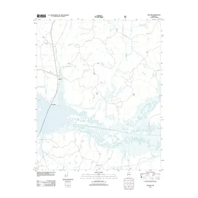
2012 Map of Malone
USGS Topo · Published 2012About this map
Sardis Lake dominates the southern reaches of this landscape, its expansive waters and wetlands fed by an intricate network of tributaries including Big Spring Cr and Little Spring Cr. The area around Malone and Spraggins reveals a rural Mississippi community defined by generations of family-named roads and landmarks. Genealogy researchers will find significant value in the distribution of local burial grounds such as Ebenezer Cem, Hamilton Cem, and Mount Maria Cem, which are scattered throughout the northern hills. The presence of the Bagley Lookout Tower near Lee Cr in the south provides a navigational anchor for this terrain. A dense network of local routes like Old Oxford Rd and Hamilton Chapel Rd illustrates the persistent road patterns that have connected these small settlements for decades.
Find a feature on this map
43 named features on this map. Tap any name to fly to it.
Don’t see what you’re looking for? This feature index may not catch every label — zoom into the map to look around manually.
Map Details
Editions of this 2012 Malone Map
This is the sole edition of this map. No revisions or reprints were ever made.
Other maps of this area

1940 · Oxford
USGS Topo · 1:62,500

1942 · Denmark
USGS Topo · 1:62,500

1943 · Denmark
USGS Topo · 1:62,500

1943 · Oxford
USGS Topo · 1:62,500

1944 · Tyro
USGS Topo · 1:62,500

1944 · Potts Camp
USGS Topo · 1:62,500

1945 · Potts Camp
USGS Topo · 1:62,500

1956 · Tupelo
USGS Topo · 1:250,000

1958 · Tupelo
USGS Topo · 1:250,000

1964 · Waterford
USGS Topo · 1:24,000