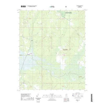
2021 Map of Malone
USGS Topo · Published 2021About this map
The boundary between Marshall and Lafayette counties cuts across this northern Mississippi landscape, where the northernmost reaches of Abbeville give way to rural terrain. The settlement of Malone sits at the junction of Old Hwy 7 S and Zanola Rd, anchoring a network of family-named roads such as Robert Ford Rd and Gilmer Rd. This area is heavily defined by the expansive Holly Springs National Forest, which covers much of the eastern half of the map.
Find a feature on this map
51 named features on this map. Tap any name to fly to it.
Don’t see what you’re looking for? This feature index may not catch every label — zoom into the map to look around manually.
Map Details
Editions of this 2021 Malone Map
This is the sole edition of this map. No revisions or reprints were ever made.
Other maps of this area

1940 · Oxford
USGS Topo · 1:62,500

1942 · Denmark
USGS Topo · 1:62,500

1943 · Denmark
USGS Topo · 1:62,500

1943 · Oxford
USGS Topo · 1:62,500

1944 · Tyro
USGS Topo · 1:62,500

1944 · Potts Camp
USGS Topo · 1:62,500

1945 · Potts Camp
USGS Topo · 1:62,500

1956 · Tupelo
USGS Topo · 1:250,000

1958 · Tupelo
USGS Topo · 1:250,000

1964 · Waterford
USGS Topo · 1:24,000