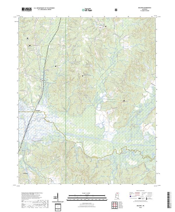
2024 Map of Malone
USGS Topo · Published 2024About this map
The Little Tallahatchie River and its confluence with the Tippah River dominate this portion of the Holly Springs National Forest along the Marshall and Lafayette County line. This modern topographic survey reveals a landscape shaped by water and tradition, where the rural settlements of Malone and Spraggins sit north of the wetlands surrounding Sardis Lake. The area is notably dense with family and community burial grounds, including Asberry Cem, Hamilton Cem, and Ebenezer Cem, many of which are associated with local congregations like the Spring Hill Baptist Church and the Spring Creek Presbyterian Church. These landmarks, along with Dukes Ferry on the river, provide a clear record of the historical crossing points and social hubs that have defined this corner of Mississippi for generations. Further south, the town of Abbeville marks a more concentrated point of development near the bottom of the quadrangle.
Find a feature on this map
57 named features on this map. Tap any name to fly to it.
Don’t see what you’re looking for? This feature index may not catch every label — zoom into the map to look around manually.
Map Details
Editions of this 2024 Malone Map
This is the sole edition of this map. No revisions or reprints were ever made.
Other maps of this area

1940 · Oxford
USGS Topo · 1:62,500

1942 · Denmark
USGS Topo · 1:62,500

1943 · Denmark
USGS Topo · 1:62,500

1943 · Oxford
USGS Topo · 1:62,500

1944 · Tyro
USGS Topo · 1:62,500

1944 · Potts Camp
USGS Topo · 1:62,500

1945 · Potts Camp
USGS Topo · 1:62,500

1956 · Tupelo
USGS Topo · 1:250,000

1958 · Tupelo
USGS Topo · 1:250,000

1964 · Waterford
USGS Topo · 1:24,000