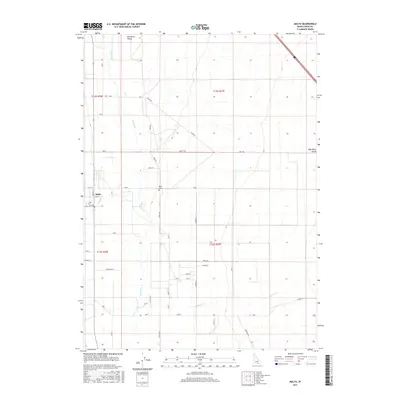
2017 Map of Malta
USGS Topo · Published 2017About this map
The Raft River meanders through the broad Raft River Valley in this 2017 study of southern Idaho's high desert agriculture. The small community of Malta serves as the focal point, situated near the confluence of Cassia Cr and the main river channel. Local history is etched into the landscape through family-named thoroughfares and rural infrastructure, including Tilfer Rd, Wake Rd, and Sublett Rd. The grid of township and range lines, such as t12s r27e, organizes the vast agricultural tracts that define the region's economy. Notable for genealogists is the Malta Cem, located just east of the town center. The map also traces southern watercourses like Meadow Cr, illustrating the vital relationship between the valley's drainage patterns and its long-standing ranching and farming operations.
Find a feature on this map
30 named features on this map. Tap any name to fly to it.
Don’t see what you’re looking for? This feature index may not catch every label — zoom into the map to look around manually.
Map Details
Editions of this 2017 Malta Map
This is the sole edition of this map. No revisions or reprints were ever made.
Other maps of this area

1954 · Pocatello
USGS Topo · 1:250,000

1958 · Pocatello
USGS Topo · 1:250,000

1958 · Sublett
USGS Topo · 1:62,500

1959 · Strevell
USGS Topo · 1:62,500

1968 · Malta NE
USGS Topo · 1:24,000

1968 · Malta
USGS Topo · 1:24,000

1968 · Idahome
USGS Topo · 1:24,000

1968 · Kane Canyon
USGS Topo · 1:24,000

1968 · Nibbs Creek
USGS Topo · 1:24,000

1968 · Bridge
USGS Topo · 1:24,000