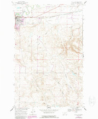
1968 Map of Malta East
USGS Topo · Published 1987About this map
The settlement of Malta serves as the focal point for this late-1960s survey, showing a landscape defined by the intersection of the Burlington Northern railroad and the winding Milk River. This area of Phillips County illustrates the essential role of water management in the northern plains, featuring an extensive network including the Dodson South Canal and Drabbels Reservoir. The town's local amenities at this time are clearly marked, including a Rodeo Ground, a Cem, and a Drive-in Theater located on the southern edge of the community. Outside the town center, the terrain is carved by natural drainage features like Morton Coulee and Gonzales Coulee, while several Gravel Pits indicate the local extractive industry that supported the region's infrastructure during this era.
Find a feature on this map
18 named features on this map. Tap any name to fly to it.
Don’t see what you’re looking for? This feature index may not catch every label — zoom into the map to look around manually.
Map Details
Editions of this 1968 Malta East Map
2 editions found
Other maps of this area

1905 · Bowdoin
USGS Topo · 1:62,500

1954 · Glasgow
USGS Topo · 1:250,000

1957 · Glasgow
USGS Topo · 1:250,000

1958 · Glasgow
USGS Topo · 1:250,000

1968 · Malta West
USGS Topo · 1:24,000
1968 · Malta NE
USGS Topo · 1:24,000

1968 · Malta East
USGS Topo · 1:24,000
1968 · Malta NW
USGS Topo · 1:24,000

1984 · Clanton Coulee
USGS Topo · 1:24,000
1984 · Lake Bowdoin
USGS Topo · 1:24,000