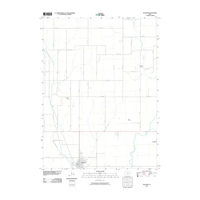
2010 Map of Malvern
USGS Topo · Published 2010About this map
Malvern serves as the central hub of this agricultural landscape in Mills County, where the regular grid of rural roads is interrupted only by the winding paths of several waterways. The West Nishnabotna River cuts across the southeastern corner near Hastings, while Silver Creek and Osborne Creek define the drainage patterns to the west. This 2010 USGS survey documents a region deeply connected to its local heritage, preserving the locations of several burial grounds such as Cottonwood Cemetery, East Liberty Cemetery, and Wearin Cemetery. The presence of the Malvern Post Office and the small settlement at Jewell highlights the distribution of community services and historical population pockets. A network of local roads, including Elderberry Ave and French Ave, provides access to the dispersed farmsteads that characterize this part of Iowa.
Find a feature on this map
24 named features on this map. Tap any name to fly to it.
Don’t see what you’re looking for? This feature index may not catch every label — zoom into the map to look around manually.
Map Details
Editions of this 2010 Malvern Map
This is the sole edition of this map. No revisions or reprints were ever made.
Other maps of this area

1954 · Omaha
USGS Topo · 1:250,000

1955 · Nebraska City
USGS Topo · 1:250,000

1956 · Glenwood
USGS Topo · 1:24,000

1956 · Mineola
USGS Topo · 1:24,000

1956 · Treynor
USGS Topo · 1:24,000

1956 · Malvern
USGS Topo · 1:24,000

1957 · Nebraska City
USGS Topo · 1:250,000

1957 · Omaha
USGS Topo · 1:250,000

1957 · Tabor
USGS Topo · 1:24,000

1957 · Tabor NE
USGS Topo · 1:24,000