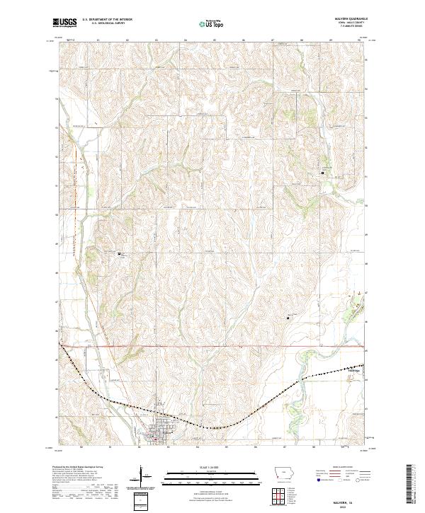
2022 Map of Malvern
USGS Topo · Published 2022About this map
Malvern and Hastings serve as the primary population centers in this rural Mills County landscape, positioned along a transportation corridor shaped by the West Nishnabotna River. The settlement pattern follows the high ground between numerous tributaries, including Silver Creek, Little Cr, and Osborne Cr. For those tracing local history or family lineage, the map identifies several well-distributed burial grounds such as Cottonwood Cem, East Liberty Cem, and Wearin Cem. A notable modern feature is the Wabash Trace Nature Trl, which follows a legacy rail alignment north to south through the terrain. The map also detail the local road network, from named country lanes like Epperson Ave and Gaston Ave to the grid-based streets of the town centers, reflecting the enduring agricultural organization of the Iowa countryside.
Find a feature on this map
38 named features on this map. Tap any name to fly to it.
Don’t see what you’re looking for? This feature index may not catch every label — zoom into the map to look around manually.
Map Details
Editions of this 2022 Malvern Map
This is the sole edition of this map. No revisions or reprints were ever made.
Other maps of this area

1954 · Omaha
USGS Topo · 1:250,000

1955 · Nebraska City
USGS Topo · 1:250,000

1956 · Glenwood
USGS Topo · 1:24,000

1956 · Mineola
USGS Topo · 1:24,000

1956 · Treynor
USGS Topo · 1:24,000

1956 · Malvern
USGS Topo · 1:24,000

1957 · Nebraska City
USGS Topo · 1:250,000

1957 · Omaha
USGS Topo · 1:250,000

1957 · Tabor
USGS Topo · 1:24,000

1957 · Tabor NE
USGS Topo · 1:24,000