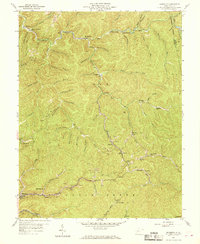
1957 Map of Mammoth
USGS Topo · Published 1969About this map
The extractive industrial landscape of the Elk and Cabin Creek districts dominates this mid-century survey, where deep hollows are defined by extensive strip mines and numerous operations simply labeled Mine. Narrow valleys host string-settlements like Blakeley, Amelia, and Hitop, while the southern edge of the sheet shows the rail-to-river infrastructure near Mammoth. The New York Central and Kellys Creek and Northwestern railroads serve as the primary conduits for coal, winding through the complex terrain of the Blue Creek watershed. In addition to the industrial footprint, the map documents a network of rural community life through several churches and schools, including the Morris Memorial Ch, Spangler Sch, and the remote Low Gap Sch. Youth camps such as Camp Carlisle and Camp Galahad appear in the northern hollows, showing a recreational layer alongside the pervasive resource extraction.
Find a feature on this map
76 named features on this map. Tap any name to fly to it.
Don’t see what you’re looking for? This feature index may not catch every label — zoom into the map to look around manually.
Map Details
Editions of this 1957 Mammoth Map
3 editions found
Other maps of this area

1897 · Kanawha Falls
USGS Topo · 1:125,000

1900 · Kanawha Falls
USGS Topo · 1:125,000

1901 · Kanawha Falls
USGS Topo · 1:125,000

1907 · Clendenin
USGS Topo · 1:62,500

1908 · Clay
USGS Topo · 1:48,000

1908 · Fayetteville
USGS Topo · 1:48,000

1908 · Montgomery
USGS Topo · 1:48,000

1909 · Clendenin
USGS Topo · 1:62,500

1910 · Clay
USGS Topo · 1:62,500

1910 · Fayetteville
USGS Topo · 1:62,500