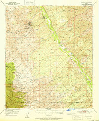
1951 Map of Mammoth
USGS Topo · Published 1951About this map
Mining operations and cattle ranching define the landscape of the San Pedro River valley during the mid-century. The settlement of Mammoth serves as a central hub, flanked by the Mammoth Cemeteries and extensive industrial sites. To the west, the community of Tiger sits amidst a concentrated network of extraction points, including the San Manuel Mine, Mammoth Mine, and Mohawk Mine. The presence of a large Tailings Pond near Tiger illustrates the scale of mineral processing in the area at the time of the 1948 field check.
Find a feature on this map
61 named features on this map. Tap any name to fly to it.
Don’t see what you’re looking for? This feature index may not catch every label — zoom into the map to look around manually.
Map Details
Editions of this 1951 Mammoth Map
2 editions found
Other maps of this area

1904 · Tucson
USGS Topo · 1:125,000

1905 · Tucson
USGS Topo · 1:125,000

1911 · Winkelman
USGS Topo · 1:125,000

1913 · Winkelman
USGS Topo · 1:125,000

1938 · Galiuro Mts
USGS Topo · 1:48,000

1938 · Klondyke
USGS Topo · 1:48,000

1943 · Galiuro Mts
USGS Topo · 1:62,500

1943 · Klondyke
USGS Topo · 1:62,500

1945 · Redington
USGS Topo · 1:62,500

1948 · Clark Ranch
USGS Topo · 1:24,000