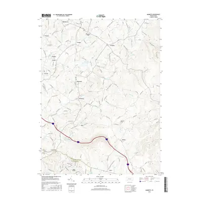
2016 Map of Mammoth
USGS Topo · Published 2016About this map
Chestnut Ridge dominates the eastern landscape of this Westmoreland County region, where the terrain shifts from agricultural valleys to the rising highlands. The settlement pattern is characterized by numerous small villages and crossroads communities including Pleasant Unity, Kecksburg, and Norvelt, reflecting the area's deep-rooted residential history. Water resources are plentiful throughout the quadrangle, notably Loyalhanna Lake in the north and the recreational Mammoth Lake near the center. The southern portion of the sheet marks the transition into Fayette County at Acme, where Acme Lake and Bear Rocks sit near the county line. This map reveals a complex network of local roads such as Moccasin Hollow Rd and Saloon Cutoff Rd that connect these historic settlements across a landscape defined by creeks like Sewickley Cr and Jacobs Cr.
Find a feature on this map
140 named features on this map. Tap any name to fly to it.
Don’t see what you’re looking for? This feature index may not catch every label — zoom into the map to look around manually.
Map Details
Editions of this 2016 Mammoth Map
This is the sole edition of this map. No revisions or reprints were ever made.
Other maps of this area

1900 · Latrobe
USGS Topo · 1:62,500

1902 · Latrobe
USGS Topo · 1:62,500

1902 · Connellsville
USGS Topo · 1:62,500

1903 · Latrobe
USGS Topo · 1:62,500

1904 · Greensburg
USGS Topo · 1:62,500

1906 · Greensburg
USGS Topo · 1:62,500

1922 · Donegal
USGS Topo · 1:62,500

1931 · Connellsville
USGS Topo · 1:62,500

1935 · Donegal
USGS Topo · 1:62,500

1936 · Connellsville
USGS Topo · 1:62,500
Featured Places
- Donegal Township, PA
- Mount Pleasant Township, PA
- Pleasant Unity, Unity Township
- Acme, Mount Pleasant Township
- Alice, Mount Pleasant Township