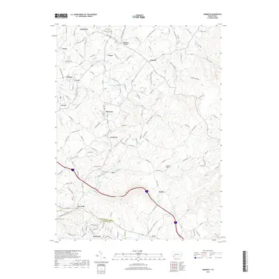
2019 Map of Mammoth
USGS Topo · Published 2019About this map
Chestnut Ridge dominates the eastern elevation of this Westmoreland County landscape, where the headwaters of Jacobs Cr and Welty Run carve out the local topography. This 2019 survey captures a network of smaller residential clusters and crossroads communities like Kecksburg, Norvelt, and Trauger, many of which remain distinct from the larger surrounding townships. Notable water bodies such as Mammoth Lake and Loyalhanna Lake serve as key landmarks within the drainage basins of Sewickley Cr and Hurst Run. For those tracing local history, the map identifies specific genealogical sites including Saint Lukes Cem near Humphreys and Brothers Cem in the southern reach. The transition from the more developed corridor near Pleasant Unity and United to the more wooded terrain of Possum Hollow illustrates the contemporary balance between residential settlement and the upland forests of southwestern Pennsylvania.
Find a feature on this map
145 named features on this map. Tap any name to fly to it.
Don’t see what you’re looking for? This feature index may not catch every label — zoom into the map to look around manually.
Map Details
Editions of this 2019 Mammoth Map
This is the sole edition of this map. No revisions or reprints were ever made.
Other maps of this area

1900 · Latrobe
USGS Topo · 1:62,500

1902 · Latrobe
USGS Topo · 1:62,500

1902 · Connellsville
USGS Topo · 1:62,500

1903 · Latrobe
USGS Topo · 1:62,500

1904 · Greensburg
USGS Topo · 1:62,500

1906 · Greensburg
USGS Topo · 1:62,500

1922 · Donegal
USGS Topo · 1:62,500

1931 · Connellsville
USGS Topo · 1:62,500

1935 · Donegal
USGS Topo · 1:62,500

1936 · Connellsville
USGS Topo · 1:62,500
Featured Places
- Donegal Township, PA
- Mount Pleasant Township, PA
- Pleasant Unity, Unity Township
- Acme, Mount Pleasant Township
- Alice, Mount Pleasant Township