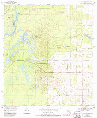
1954 Map of Manatee Springs
USGS Topo · Published 1988About this map
The Suwannee River carves the western boundary of this landscape, separating Dixie and Levy counties. The area is defined by its significant karst hydrology, where features like Manatee Springs and Willow Sink indicate a complex subterranean water system. Within Manatee Springs State Park, the spring-fed waters transition into the river near Lower Clay Landing. Moving inland, the terrain opens into the Piney Prairie, a landscape dotted with numerous ponds such as Sand Pond, Drummond Pond, and Bonnet Pond. This 1950s era survey, with updates from the 1980s, highlights localized cultural sites including Antioch Cem and the Long Pond Ch near the banks of Long Pond. The presence of a Quarry and scattered cemeteries suggests a quiet, resource-dependent rural life typical of north-central Florida during the mid-20th century.
Find a feature on this map
19 named features on this map. Tap any name to fly to it.
Don’t see what you’re looking for? This feature index may not catch every label — zoom into the map to look around manually.
Map Details
Editions of this 1954 Manatee Springs Map
3 editions found
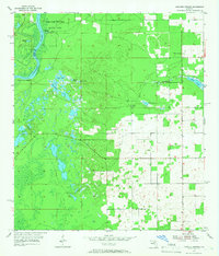
Other maps of this area

1954 · Eugene
USGS Topo · 1:24,000

1954 · Chiefland
USGS Topo · 1:24,000

1954 · Otter Creek
USGS Topo · 1:24,000

1954 · Manatee Springs
USGS Topo · 1:24,000

1954 · Chiefland SW
USGS Topo · 1:24,000

1954 · Vista
USGS Topo · 1:24,000

1954 · East Pass
USGS Topo · 1:24,000

1954 · Gainesville
USGS Topo · 1:250,000

1958 · Gainesville
USGS Topo · 1:250,000

1959 · Gainesville
USGS Topo · 1:250,000