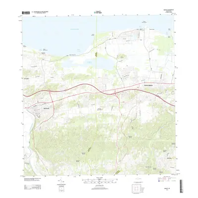
2013 Map of Manati
USGS Topo · Published 2013About this map
The coastal and inland interface of Manatí and Vega Baja defines this landscape, where the northern shore meets the Atlantic Ocean. The geography is shaped by significant water bodies, including the protected waters of Laguna Tortuguero and the Río Grande de Manatí which winds along the western edge of the survey. The inland terrain rises into prominent elevations such as Cerro del Faro and Cerro Guarico, while the coast is marked by distinctive points like Punta Chivato and Punta Garza. Settlement patterns are concentrated along major thoroughfares like the PR-2, with residential clusters in Miranda and the beach communities of Playa Puerto Nuevo and Playa de Vega. Numerous smaller streams, including Quebrada Hicatea and Quebrada El Salto, drain the northern slopes, illustrating the intricate watershed that supports the region's agricultural and urban development.
Find a feature on this map
69 named features on this map. Tap any name to fly to it.
Don’t see what you’re looking for? This feature index may not catch every label — zoom into the map to look around manually.
Map Details
Editions of this 2013 Manati Map
This is the sole edition of this map. No revisions or reprints were ever made.
Other maps of this area

1940 · Vega Alta
USGS Topo · 1:30,000

1942 · Manati
USGS Topo · 1:30,000

1942 · Barceloneta
USGS Topo · 1:30,000

1946 · Corozal
USGS Topo · 1:30,000

1946 · Barceloneta
USGS Topo · 1:30,000

1946 · Ciales
USGS Topo · 1:30,000

1946 · Florida
USGS Topo · 1:30,000

1946 · Vega Alta
USGS Topo · 1:30,000

1946 · Manati
USGS Topo · 1:30,000

1947 · Corozal NO
USGS Topo · 1:10,000