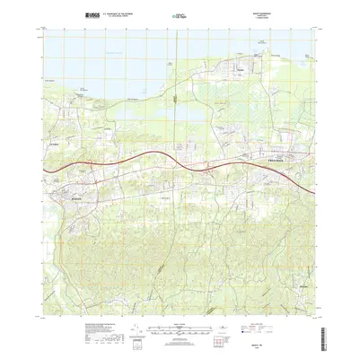
2018 Map of Manati
USGS Topo · Published 2018About this map
Manatí and Vega Baja anchor this coastal reach of northern Puerto Rico, where the limestone karst topography meets the Atlantic shoreline. The landscape is defined by its transition from the steep, hummocky hills of Cerro del Faro and Cerro Guarico to the coastal plains and lagoons near Playa Tortuguero. Infrastructure like the Expreso Jose de Diego cuts across the terrain, linking the urban centers of the two municipalities. Along the coast, distinctive geographic points such as Punta Chivato and Punta Boquilla frame protected waters like Mar Chiquita.
Find a feature on this map
43 named features on this map. Tap any name to fly to it.
Don’t see what you’re looking for? This feature index may not catch every label — zoom into the map to look around manually.
Map Details
Editions of this 2018 Manati Map
This is the sole edition of this map. No revisions or reprints were ever made.
Other maps of this area

1940 · Vega Alta
USGS Topo · 1:30,000

1942 · Manati
USGS Topo · 1:30,000

1942 · Barceloneta
USGS Topo · 1:30,000

1946 · Corozal
USGS Topo · 1:30,000

1946 · Barceloneta
USGS Topo · 1:30,000

1946 · Ciales
USGS Topo · 1:30,000

1946 · Florida
USGS Topo · 1:30,000

1946 · Vega Alta
USGS Topo · 1:30,000

1946 · Manati
USGS Topo · 1:30,000

1947 · Corozal NO
USGS Topo · 1:10,000