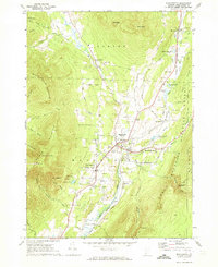
1968 Map of Manchester
USGS Topo · Published 1973About this map
The valley floor of Manchester and Dorset is defined by a dense network of country roads and the Vermont Railway corridor, which shadows the Batten Kill as it flows south toward Richville. This 1960s landscape shows the transition from a resource-based economy of numerous Gravel Pits to a regional cultural hub, evidenced by the Southern Vermont Art Center and the Burr-Barton Seminary. The map captures distinct village clusters at Manchester Center and Manchester Depot, showing the local importance of education and faith with institutions like the Mt Laurel Sch and St Jeromes Ch.
Find a feature on this map
76 named features on this map. Tap any name to fly to it.
Don’t see what you’re looking for? This feature index may not catch every label — zoom into the map to look around manually.
Map Details
Editions of this 1968 Manchester Map
4 editions found
Other maps of this area

1893 · Wallingford
USGS Topo · 1:62,500

1894 · Londonderry
USGS Topo · 1:62,500

1894 · Pawlet
USGS Topo · 1:62,500

1894 · Equinox
USGS Topo · 1:62,500

1896 · Equinox
USGS Topo · 1:62,500

1897 · Pawlet
USGS Topo · 1:62,500

1899 · Londonderry
USGS Topo · 1:62,500

1900 · Equinox
USGS Topo · 1:62,500

1903 · Mettawee
USGS Topo · 1:125,000

1950 · Glens Falls
USGS Topo · 1:250,000