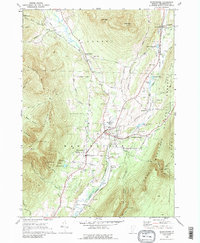
1968 Map of Manchester
USGS Topo · Published 1989About this map
Equinox Mountain towers over the landscape of Bennington County, defining the western horizon where the Sky Line Private Road climbs toward Lookout Rock. The valley below reveals a sophisticated mid-century cultural and educational hub, anchored by the storied Burr-Barton Seminary and the Southern Vermont Art Center. The transition from industrial roots to a recreation-based economy is evident in the cluster of Gravel Pits near Manchester Depot contrasted with the Ekwwanok Country Club and the Equinox Landing Field.
Find a feature on this map
75 named features on this map. Tap any name to fly to it.
Don’t see what you’re looking for? This feature index may not catch every label — zoom into the map to look around manually.
Map Details
Editions of this 1968 Manchester Map
4 editions found
Other maps of this area

1893 · Wallingford
USGS Topo · 1:62,500

1894 · Londonderry
USGS Topo · 1:62,500

1894 · Pawlet
USGS Topo · 1:62,500

1894 · Equinox
USGS Topo · 1:62,500

1896 · Equinox
USGS Topo · 1:62,500

1897 · Pawlet
USGS Topo · 1:62,500

1899 · Londonderry
USGS Topo · 1:62,500

1900 · Equinox
USGS Topo · 1:62,500

1903 · Mettawee
USGS Topo · 1:125,000

1950 · Glens Falls
USGS Topo · 1:250,000