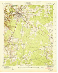
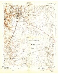
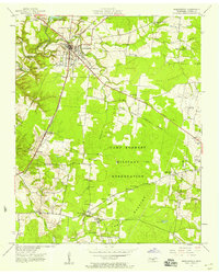
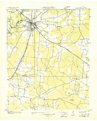
1941 Map of Manchester
USGS Topo · Published 1943About this map
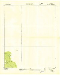
Manchester serves as the focal point of this Coffee County study, situated at the confluence of the Duck River and Little Duck River. The landscape is dominated by the sprawling Camp Forrest Military Reservation, which covers a significant portion of the southern and eastern territory, bordering the distinctive The Barrens and Hickory Flat. This era captures the town's transition during the early years of the war, showing the Nashville Chattanooga and St Louis railway cutting through the center of town near the Fairgrounds.
Find a feature on this map
45 named features on this map. Tap any name to fly to it.
Don’t see what you’re looking for? This feature index may not catch every label — zoom into the map to look around manually.
Map Details
Editions of this 1941 Manchester Map
3 editions found
Other maps of this area

1893 · Mc Minnville
USGS Topo · 1:125,000

1895 · Mc Minnville
USGS Topo · 1:125,000

1895 · Sewanee
USGS Topo · 1:125,000

1913 · Hollow Springs
USGS Topo · 1:62,500

1936 · Ovoca
USGS Topo · 1:24,000

1936 · Alto
USGS Topo · 1:24,000

1936 · Fredonia
USGS Topo · 1:24,000
1936 · Manchester
USGS Topo · 1:24,000

1936 · Noah
USGS Topo · 1:24,000
1936 · Morrison
USGS Topo · 1:24,000