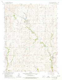
1965 Map of Manchester
USGS Topo · Published 1978About this map
Manchester and Talmage anchor this mid-1960s survey of north-central Kansas, where the Atchison Topeka and Santa Fe railroad cuts a diagonal path through the prairie landscape. The map details a region defined by its townships, including Flora, Willowdale, and Cheever, reflecting the structured land divisions of Dickinson County. Natural drainage is dominated by the meandering course of Mud Creek and the southern flow of Buckeye Creek.
Find a feature on this map
13 named features on this map. Tap any name to fly to it.
Don’t see what you’re looking for? This feature index may not catch every label — zoom into the map to look around manually.
Map Details
Editions of this 1965 Manchester Map
2 editions found
Other maps of this area

1889 · Abilene
USGS Topo · 1:125,000

1891 · Clay Center
USGS Topo · 1:125,000

1894 · Abilene
USGS Topo · 1:125,000

1955 · Niles
USGS Topo · 1:24,000

1955 · Manhattan
USGS Topo · 1:250,000

1955 · Hutchinson
USGS Topo · 1:250,000

1956 · Manhattan
USGS Topo · 1:250,000

1957 · Manhattan
USGS Topo · 1:250,000

1959 · Hutchinson
USGS Topo · 1:250,000
1963 · Solomon
USGS Topo · 1:24,000