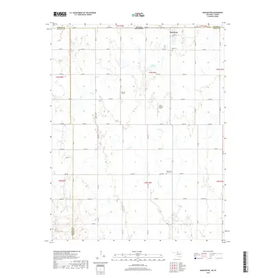
2018 Map of Manchester
USGS Topo · Published 2018About this map
The town of Manchester sits just south of the Stateline Rd, anchoring a northern Oklahoma landscape defined by its grid-based agricultural layout and proximity to the Kansas border. This 2018 survey detail shows a region shaped by small-scale aviation and long-established community landmarks. The area surrounding the town includes Mc Crays Airport and Miller Brothers Airport, reflecting the importance of private aviation in rural Grant County. Water features like Cooper Cr and Sand Cr meander across the township lines of t29n r8w and t28n r8w, occasionally feeding small catchments like the 053001 Reservoir. For those tracing local heritage, the map provides precise locations for the Manchester Cem and the Saints Peter and Paul Cem, which serve as vital points of reference for the families who have worked these fields for generations.
Find a feature on this map
40 named features on this map. Tap any name to fly to it.
Don’t see what you’re looking for? This feature index may not catch every label — zoom into the map to look around manually.
Map Details
Editions of this 2018 Manchester Map
This is the sole edition of this map. No revisions or reprints were ever made.
Other maps of this area

1889 · Anthony
USGS Topo · 1:125,000

1889 · Caldwell
USGS Topo · 1:125,000

1891 · Anthony
USGS Topo · 1:125,000

1893 · Caldwell
USGS Topo · 1:125,000

1897 · Caldwell
USGS Topo · 1:125,000

1955 · Wichita
USGS Topo · 1:250,000

1955 · Enid
USGS Topo · 1:250,000

1955 · Woodward
USGS Topo · 1:250,000

1955 · Pratt
USGS Topo · 1:250,000

1958 · Enid
USGS Topo · 1:250,000