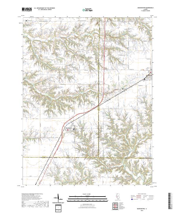
2024 Map of Manchester
USGS Topo · Published 2024About this map
Manchester and Murrayville anchor this rural landscape at the intersection of Scott, Morgan, and Greene counties. The terrain is defined by a dense network of country roads, including Woodson Winchester Rd, Ratliff Rd, and Midway Rd, which facilitate movement across the agricultural heartland. For those researching family history, the area is notably rich in burial sites, ranging from the Old Manchester Cem and Manchester Cem near the town center to the more isolated Canatsey Cem in the north. The proximity of Bethel Cem and Murrayville Cem further highlights the deep-rooted settlement patterns of this Central Illinois region. The local geography is etched with numerous named arteries like Thady Rd and S Smokey Ln, reflecting a legacy of family landholdings and small-town connectivity.
Find a feature on this map
56 named features on this map. Tap any name to fly to it.
Don’t see what you’re looking for? This feature index may not catch every label — zoom into the map to look around manually.
Map Details
Editions of this 2024 Manchester Map
This is the sole edition of this map. No revisions or reprints were ever made.
Other maps of this area

1924 · Winchester
USGS Topo · 1:48,000

1924 · Roodhouse
USGS Topo · 1:62,500

1926 · Winchester
USGS Topo · 1:62,500

1926 · Roodhouse
USGS Topo · 1:62,500

1932 · Greenfield
USGS Topo · 1:62,500

1932 · Jacksonville
USGS Topo · 1:62,500

1937 · Jacksonville
USGS Topo · 1:62,500

1948 · Quincy
USGS Topo · 1:250,000

1956 · Quincy
USGS Topo · 1:250,000
1983 · Alsey
USGS Topo · 1:24,000