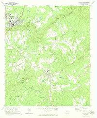
1971 Map of Manchester
USGS Topo · Published 1973About this map
Pine Mountain and Oak Mountain dominate the landscape of the Georgia Piedmont in the early 1970s, creating a series of gaps and knobs that dictated the path of early settlements and railroads. The Seaboard Coast Line winds through the terrain, connecting the industrial hub of Manchester in the northwest to the smaller communities of Woodland and Belleview. The map reveals a transition between rural crossroads and established towns, with points like Cunningham Crossroads and Tax Crossroads serving as local landmarks. Cultural life is anchored by country churches and schools, such as Valley Grove Ch and Woodland Sch. Water resources are central to the area's development, evidenced by Greens Mill on Lazer Creek and the resort history implied by Chalybeate Springs near Millen Gap. The rugged topography is further defined by landmarks like Turkey Knob and various passes including Johnson Gap and Stephenson Gap.
Find a feature on this map
48 named features on this map. Tap any name to fly to it.
Don’t see what you’re looking for? This feature index may not catch every label — zoom into the map to look around manually.
Map Details
Editions of this 1971 Manchester Map
2 editions found
Other maps of this area

1907 · Talbotton
USGS Topo · 1:125,000

1934 · Warm Springs
USGS Topo · 1:62,500

1935 · Thomaston
USGS Topo · 1:48,000

1936 · Warm Springs
USGS Topo · 1:62,500

1939 · Thomaston
USGS Topo · 1:62,500

1950 · Talbotton
USGS Topo · 1:24,000

1950 · Waverly Hall
USGS Topo · 1:24,000

1950 · Talbotton
USGS Topo · 1:62,500

1955 · Talbotton
USGS Topo · 1:24,000
1955 · Waverly Hall
USGS Topo · 1:24,000