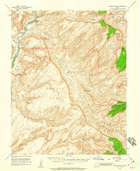
1952 Map of Mancos Mesa
USGS Topo · Published 1960About this map
The Colorado River carves a deep boundary along the western edge of this remote high-desert landscape in San Juan and Garfield counties. Surveyed in the early 1950s using aerial photography, the map reveals a wilderness of massive landforms including the expansive Mancos Mesa and the distinctively named Chocolate Drop. Along the river's path, navigators faced the Ticaboo No 1 Rapids and Ticaboo No 2 Rapids, while the presence of a Landing Strip and Good Hope Bar suggests the era's scattered mining and exploration activity. Massive drainage systems like Red Canyon, Blue Canyon, and Moki Canyon dominate the topography, illustrating the complex erosion patterns that define this stretch of the Utah canyonlands before the significant changes brought by later regional developments.
Find a feature on this map
31 named features on this map. Tap any name to fly to it.
Don’t see what you’re looking for? This feature index may not catch every label — zoom into the map to look around manually.
Map Details
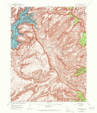
Editions of this 1952 Mancos Mesa Map
3 editions found
Other maps of this area

1886 · Henry Mountains
USGS Topo · 1:250,000

1892 · Henry Mountains
USGS Topo · 1:250,000

1952 · Mouth of Dark Canyon
USGS Topo · 1:62,500

1952 · Mancos Mesa
USGS Topo · 1:62,500

1952 · Natural Bridges
USGS Topo · 1:62,500

1952 · Mt Hillers
USGS Topo · 1:62,500

1952 · Mt Pennell 1 SE
USGS Topo · 1:24,000

1952 · Hite
USGS Topo · 1:62,500

1953 · Mt Pennell 4 NE
USGS Topo · 1:24,000

1953 · Lake Canyon
USGS Topo · 1:62,500