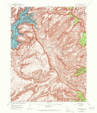
1952 Map of Mancos Mesa
USGS Topo · Published 1971About this map
Lake Powell dominates the northwest corner of this remote desert landscape, reflecting the significant geographic shifts in the region during the mid-20th century. The reservoir's waters fill the deep reaches of Good Hope Bay and the winding course of the Colorado River, pushing into the mouths of smaller drainages like Ticaboo Cr. Much of the map's western half is designated as the Glen Canyon National Recreation Area, where the rising water table contrasts with the arid high ground of the Mancos Mesa. This tableland is carved by a complex network of steep drainages, including Red Canyon, Moqui Canyon, and North Gulch. Standing as landmarks amidst the intricate contour lines are distinctive formations such as Castle Butte and Chocolate Drop, which provide orientation in a terrain defined by its erosion patterns and isolation.
Find a feature on this map
16 named features on this map. Tap any name to fly to it.
Don’t see what you’re looking for? This feature index may not catch every label — zoom into the map to look around manually.
Map Details
Editions of this 1952 Mancos Mesa Map
3 editions found
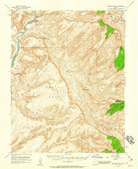
Other maps of this area

1886 · Henry Mountains
USGS Topo · 1:250,000

1892 · Henry Mountains
USGS Topo · 1:250,000

1952 · Mouth of Dark Canyon
USGS Topo · 1:62,500

1952 · Mancos Mesa
USGS Topo · 1:62,500

1952 · Natural Bridges
USGS Topo · 1:62,500

1952 · Mt Hillers
USGS Topo · 1:62,500

1952 · Mt Pennell 1 SE
USGS Topo · 1:24,000

1952 · Hite
USGS Topo · 1:62,500

1953 · Mt Pennell 4 NE
USGS Topo · 1:24,000

1953 · Lake Canyon
USGS Topo · 1:62,500