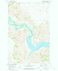
1970 Map of Mandaree SW
USGS Topo · Published 1978About this map
Lake Sakakawea dominates the landscape of Dunn County, North Dakota, following a 1970 field check of the Missouri River Basin’s development. The map details the complex shoreline of this reservoir where it meets the Little Missouri River, noting a specific pool elevation of 1838 feet. Much of the northern and western terrain is defined by the Fort Berthold Indian Reservation Boundary, illustrating the intersection of tribal lands with the altered hydrology of the river valley. Numerous drainages such as Moccasin Creek and Jim Creek feed into the reservoir, carving through the upland topography of the Mandaree SW quadrangle. Areas marked by a light-blue dashed pattern indicate zones subject to controlled inundation, a critical detail for understanding the managed water levels of the era.
Find a feature on this map
8 named features on this map. Tap any name to fly to it.
Don’t see what you’re looking for? This feature index may not catch every label — zoom into the map to look around manually.
Map Details
Editions of this 1970 Mandaree SW Map
2 editions found
Other maps of this area

1953 · Watford City
USGS Topo · 1:250,000

1957 · Watford City
USGS Topo · 1:250,000

1967 · Watford City
USGS Topo · 1:250,000

1970 · Mandaree
USGS Topo · 1:24,000

1970 · Lost Bridge
USGS Topo · 1:24,000

1970 · Figure 4 Ranch
USGS Topo · 1:24,000

1970 · Dunn Center NW
USGS Topo · 1:24,000

1970 · Mandaree SW
USGS Topo · 1:24,000

1970 · Dunn Center NE
USGS Topo · 1:24,000

1970 · Mandaree SE
USGS Topo · 1:24,000