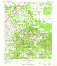
1952 Map of Mandeville
USGS Topo · Published 1971About this map
The Missouri Pacific and St Louis Southwestern railroads anchor the industrial and social landscape of Miller County, framing a region defined by scattered farming settlements and early infrastructure. Mandeville and Genoa serve as primary points of interest, while the presence of Oil Tanks, a Radio Range Sta, and an Oil Well point to the area's mid-century economic drivers.
Find a feature on this map
47 named features on this map. Tap any name to fly to it.
Don’t see what you’re looking for? This feature index may not catch every label — zoom into the map to look around manually.
Map Details
Editions of this 1952 Mandeville Map
4 editions found
Other maps of this area

1909 · Texarkana
USGS Topo · 1:62,500

1950 · Ogden
USGS Topo · 1:24,000

1951 · Ogden
USGS Topo · 1:24,000

1951 · Homan
USGS Topo · 1:24,000

1951 · Fulton
USGS Topo · 1:24,000

1952 · Mandeville
USGS Topo · 1:24,000

1952 · Fouke SE
USGS Topo · 1:24,000

1952 · Fouke
USGS Topo · 1:24,000

1952 · Fouke NE
USGS Topo · 1:24,000

1953 · Texarkana
USGS Topo · 1:250,000