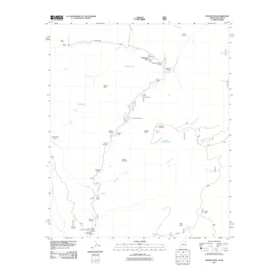
2011 Map of Maness Peak
USGS Topo · Published 2011About this map
Whispering Pines and several family holdings occupy the remote river valleys along the Arizona-New Mexico border in this 2011 survey. The landscape is defined by the winding course of the Blue River, where early 21st-century ranching and recreation intersect. Small-scale human signatures are scattered throughout the canyons, including the Blue Cemetery and the Burke Ranch near Centerfire Creek. To the south, Blue Crossing serves as a focal point near School House Canyon, indicating the historical importance of water access and local education in this high-elevation terrain. The presence of numerous springs like Noland Spring and Mexican Spring highlights the critical nature of water resources for the scattered outposts like Luce Ranch and Fogg 8 Ranch. This map documents a quiet, resilient ranching culture maintained within a complex network of canyons and peaks like Maness Mountain and Milligan Peak.
Find a feature on this map
57 named features on this map. Tap any name to fly to it.
Don’t see what you’re looking for? This feature index may not catch every label — zoom into the map to look around manually.
Map Details
Editions of this 2011 Maness Peak Map
This is the sole edition of this map. No revisions or reprints were ever made.
Other maps of this area

1915 · Reserve
USGS Topo · 1:125,000

1918 · Reserve
USGS Topo · 1:125,000

1922 · Nutrioso
USGS Topo · 1:125,000

1954 · Clifton
USGS Topo · 1:250,000

1957 · Clifton
USGS Topo · 1:250,000

1958 · Clifton
USGS Topo · 1:250,000

1958 · Alpine
USGS Topo · 1:62,500

1961 · Blue
USGS Topo · 1:62,500

1962 · Clifton
USGS Topo · 1:250,000
1963 · Saliz Pass
USGS Topo · 1:24,000