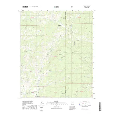
2018 Map of Maness Peak
USGS Topo · Published 2018About this map
The Apache National Forest straddles the rugged boundary between Arizona and New Mexico, where the Blue River carves a deep path through the San Francisco Mountains. This 2018 survey reveals a landscape of high-elevation peaks and remote water sources, anchored by Milligan Peak and Maness Peak. The small settlement of Whispering Pines and the Blue Cem offer evidence of human presence in this high-country wilderness, while the Blue River drainage serves as the primary topographical artery. The map provides clear detail of the numerous springs and tanks essential for life in this arid environment, such as Schoolhouse Spring and Stateline Tank Number 2. With elevations exceeding 8,000 feet at Horse Mesa, the terrain is defined by complex canyon systems including Mother Hubbard Canyon and Frieborn Canyon, which transition into open areas like Bobcat Flat.
Find a feature on this map
83 named features on this map. Tap any name to fly to it.
Don’t see what you’re looking for? This feature index may not catch every label — zoom into the map to look around manually.
Map Details
Editions of this 2018 Maness Peak Map
This is the sole edition of this map. No revisions or reprints were ever made.
Other maps of this area

1915 · Reserve
USGS Topo · 1:125,000

1918 · Reserve
USGS Topo · 1:125,000

1922 · Nutrioso
USGS Topo · 1:125,000

1954 · Clifton
USGS Topo · 1:250,000

1957 · Clifton
USGS Topo · 1:250,000

1958 · Clifton
USGS Topo · 1:250,000

1958 · Alpine
USGS Topo · 1:62,500

1961 · Blue
USGS Topo · 1:62,500

1962 · Clifton
USGS Topo · 1:250,000
1963 · Saliz Pass
USGS Topo · 1:24,000