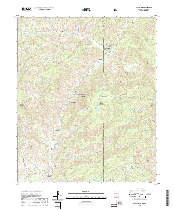
2021 Map of Maness Peak
USGS Topo · Published 2021About this map
Apache National Forest straddles the high-altitude border of Arizona and New Mexico, where the Blue River carves a deep path through the San Francisco Mountains. This 2021 survey reveals a landscape of remote peaks and canyons, centered around Maness Peak and Milligan Peak. Evidence of local history and backcountry movement is preserved through named features like Whispering Pines and the Blue Cem, which sits near the river's edge. The rugged geography is defined by numerous drainages, including Swafford Canyon and School House Canyon, alongside established paths such as the Mother Hubbard Trl and the Frieborn Access Trl. Smaller water sources like Schoolhouse Spring and Jack Spring provide critical landmarks in a region dominated by high mesas and isolated flats like Bobcat Flat.
Find a feature on this map
66 named features on this map. Tap any name to fly to it.
Don’t see what you’re looking for? This feature index may not catch every label — zoom into the map to look around manually.
Map Details
Editions of this 2021 Maness Peak Map
This is the sole edition of this map. No revisions or reprints were ever made.
Other maps of this area

1915 · Reserve
USGS Topo · 1:125,000

1918 · Reserve
USGS Topo · 1:125,000

1922 · Nutrioso
USGS Topo · 1:125,000

1954 · Clifton
USGS Topo · 1:250,000

1957 · Clifton
USGS Topo · 1:250,000

1958 · Clifton
USGS Topo · 1:250,000

1958 · Alpine
USGS Topo · 1:62,500

1961 · Blue
USGS Topo · 1:62,500

1962 · Clifton
USGS Topo · 1:250,000
1963 · Saliz Pass
USGS Topo · 1:24,000