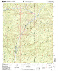
1997 Map of Maness Peak
USGS Topo · Published 2000About this map
Blue River valley life in the late 1990s is documented here as it winds through the eastern reaches of the Apache National Forest. This remote corridor along the Arizona and New Mexico border shows a landscape defined by ranching and high-elevation terrain. Isolated outposts like Luce Ranch, Blue River Ranch, and the Fogg Cabin are situated near the perennial waters of Campbell Blue Creek and the main river. These family-named landmarks, along with the Blue Cemetery and Blue School, represent the enduring social anchors of this rural community.
Find a feature on this map
76 named features on this map. Tap any name to fly to it.
Don’t see what you’re looking for? This feature index may not catch every label — zoom into the map to look around manually.
Map Details
Editions of this 1997 Maness Peak Map
This is the sole edition of this map. No revisions or reprints were ever made.
Other maps of this area

1915 · Reserve
USGS Topo · 1:125,000

1918 · Reserve
USGS Topo · 1:125,000

1922 · Nutrioso
USGS Topo · 1:125,000

1954 · Clifton
USGS Topo · 1:250,000

1957 · Clifton
USGS Topo · 1:250,000

1958 · Clifton
USGS Topo · 1:250,000

1958 · Alpine
USGS Topo · 1:62,500

1961 · Blue
USGS Topo · 1:62,500

1962 · Clifton
USGS Topo · 1:250,000
1963 · Saliz Pass
USGS Topo · 1:24,000