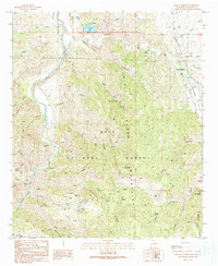
1990 Map of Mangas Springs
USGS Topo · Published 1991About this map
The Big Burro Mountains and the Gila National Forest dominate this Southwestern landscape, where the Gila River cuts through the western edge of the quadrangle. This 1990 survey captures the rugged mining and ranching character of Grant County, centered around the Mangas Springs settlement and the nearby waters of Bill Evans Lake. The terrain is deeply incised by complex canyon systems like Schoolhouse Canyon and Davis Canyon, which historically dictated movement through the high country.
Find a feature on this map
69 named features on this map. Tap any name to fly to it.
Don’t see what you’re looking for? This feature index may not catch every label — zoom into the map to look around manually.
Map Details
Editions of this 1990 Mangas Springs Map
This is the sole edition of this map. No revisions or reprints were ever made.
Other maps of this area

1909 · Silver City
USGS Topo · 1:125,000

1949 · Circle Mesa
USGS Topo · 1:24,000

1950 · Dorsey Ranch
USGS Topo · 1:24,000

1950 · Wind Mountain
USGS Topo · 1:24,000

1951 · Circle Mesa
USGS Topo · 1:24,000

1951 · Dorsey Ranch
USGS Topo · 1:24,000

1951 · Wind Mountain
USGS Topo · 1:24,000

1954 · Silver City
USGS Topo · 1:250,000

1958 · Silver City
USGS Topo · 1:250,000

1959 · Redrock
USGS Topo · 1:62,500