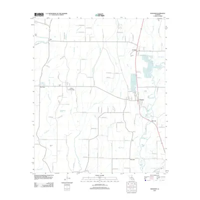
2012 Map of Mangham
USGS Topo · Published 2012About this map
The town of Mangham and the neighboring community of Archibald anchor this portion of Richland Parish, where the local economy follows a long-established pattern of agriculture and bayou-side settlement. The landscape is defined by an intricate network of waterways, including Bee Bayou and Mose Bayou, which drain the flat delta lands toward the Boeuf River. In the western portion of the quadrangle, Alto and Four Forks represent smaller rural nodes connected by historically significant routes like Old Alto Rd. The map reveals a high density of small family and community burial grounds, such as Saint Luke Cem, Prewitt Cem, and Gwin Cem, which offer significant value for genealogical research. The presence of Bobby Jones Flying Service Inc Airport suggests the importance of aerial application for the region's expansive agricultural fields, while names like Persimmon Pond and Ash Slough speak to the original wetland character of the lower Mississippi Valley.
Find a feature on this map
118 named features on this map. Tap any name to fly to it.
Don’t see what you’re looking for? This feature index may not catch every label — zoom into the map to look around manually.
Map Details
Editions of this 2012 Mangham Map
This is the sole edition of this map. No revisions or reprints were ever made.
Other maps of this area

1935 · Winnsboro
USGS Topo · 1:62,500

1935 · Alto
USGS Topo · 1:62,500

1935 · Baskinton
USGS Topo · 1:62,500

1939 · Fort Necessity
USGS Topo · 1:62,500

1955 · Jackson
USGS Topo · 1:250,000

1957 · Mangham
USGS Topo · 1:62,500

1958 · Baskinton
USGS Topo · 1:62,500

1958 · Winnsboro
USGS Topo · 1:62,500

1958 · Fort Necessity
USGS Topo · 1:62,500

1961 · Jackson
USGS Topo · 1:250,000