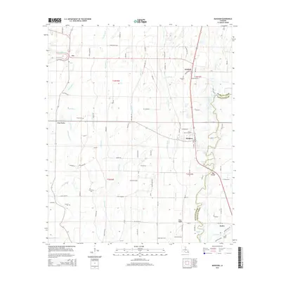
2015 Map of Mangham
USGS Topo · Published 2015About this map
Mangham sits at a geographic crossroads in the heart of Louisiana's delta country, where the landscape is defined by the intricate winding of Big Creek and the Boeuf River. This survey captures a rural landscape heavily influenced by its hydrology, where local life follows the paths of Muddy Bayou and Spice Bayou. The map illustrates the transition from the community of Alto in the northwest down toward Baskin and New Light in the south, following the clear north-south orientation of the local road and rail infrastructure. For those interested in family history, the map identifies numerous local burying grounds including Gwin Memorial Cem, China Grove Cem, and Archibald Cem. The agricultural nature of the land is evident in the sparse settlement patterns and the reliance on named drainage features like Ash Slough and Otter Slough to manage the fertile but low-lying terrain of Richland and Franklin Parishes.
Find a feature on this map
94 named features on this map. Tap any name to fly to it.
Don’t see what you’re looking for? This feature index may not catch every label — zoom into the map to look around manually.
Map Details
Editions of this 2015 Mangham Map
This is the sole edition of this map. No revisions or reprints were ever made.
Other maps of this area

1935 · Winnsboro
USGS Topo · 1:62,500

1935 · Alto
USGS Topo · 1:62,500

1935 · Baskinton
USGS Topo · 1:62,500

1939 · Fort Necessity
USGS Topo · 1:62,500

1955 · Jackson
USGS Topo · 1:250,000

1957 · Mangham
USGS Topo · 1:62,500

1958 · Baskinton
USGS Topo · 1:62,500

1958 · Winnsboro
USGS Topo · 1:62,500

1958 · Fort Necessity
USGS Topo · 1:62,500

1961 · Jackson
USGS Topo · 1:250,000