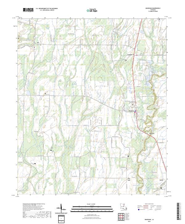
2024 Map of Mangham
USGS Topo · Published 2024About this map
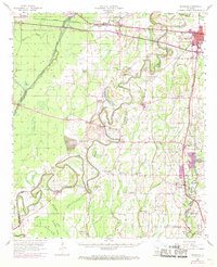
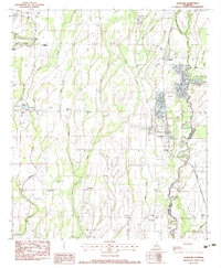
The Boeuf River winds through the western edge of this agricultural landscape, anchoring a network of waterways including Mose Bayou, Spice Bayou, and Ash Slough. This region of Louisiana is defined by its small, scattered settlements and a dense grid of rural parish roads that connect farming communities. The town of Mangham serves as a central hub, while smaller places like Archibald, Alto, and Baskin are situated along the primary north-south transit corridors. Significant for genealogists and local historians, the area is dotted with family and community landmarks such as the Archibald Cem, Saint Luke Cem, and China Grove Cem. The presence of several small lakes, including Sayre Lake and Tank Lake, points to the low-lying, water-rich character of the land between Richland Parish and Franklin Parish.
Find a feature on this map
102 named features on this map. Tap any name to fly to it.
Don’t see what you’re looking for? This feature index may not catch every label — zoom into the map to look around manually.
Map Details
Editions of this 2024 Mangham Map
This is the sole edition of this map. No revisions or reprints were ever made.
Historical Maps of Four Forks Through Time
3 maps found