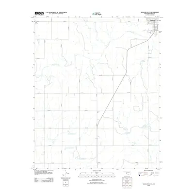
2012 Map of Mangum South
USGS Topo · Published 2012About this map
Mangum anchors the northern edge of this Greer County landscape, where the town's residential grid meets the meandering path of the Salt Fork Red River. The river system is a defining element, joined by tributaries such as Mulberry Cr, Fish Cr, and Horse Br. For those tracing local family history, several burial grounds are documented, including Riverside Cem, White Flat Cem, and the more centrally located Ladessa Cem.
Find a feature on this map
36 named features on this map. Tap any name to fly to it.
Don’t see what you’re looking for? This feature index may not catch every label — zoom into the map to look around manually.
Map Details
Editions of this 2012 Mangum South Map
This is the sole edition of this map. No revisions or reprints were ever made.
Other maps of this area

1955 · Lawton
USGS Topo · 1:250,000

1964 · Martha
USGS Topo · 1:24,000

1971 · Russell
USGS Topo · 1:24,000

1971 · Mangum North
USGS Topo · 1:24,000

1971 · Granite
USGS Topo · 1:24,000

1971 · Mangum South
USGS Topo · 1:24,000

1971 · Mc Queen
USGS Topo · 1:24,000

1971 · Duke
USGS Topo · 1:24,000

1971 · Hester
USGS Topo · 1:24,000

1971 · Reed
USGS Topo · 1:24,000