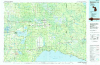
1985 Map of Manistique Lake
USGS Topo · Published 1985About this map
Newberry serves as the regional hub for this portion of the Upper Peninsula, situated at the intersection of a vast wetland drainage system and the Soo Line railroad. The landscape is defined by the massive Tahquamenon River watershed and the expansive Seney National Wildlife Refuge to the west. Evidence of the region’s timber and transit history is preserved through numerous stretches of Old RR Grade and an abandoned rail line that once cut through the dense Lake Superior State Forest. Along the southern shore, small fishing and milling settlements like Naubinway and Epoufette look out over Lake Michigan, while the interior is dotted with significant water bodies including Manistique Lake and Millecoquins Lake. The presence of the State Hospital near Newberry and industrial sites like the Calspar Quarry Pool reflect the institutional and extractive economic pillars of the era.
Find a feature on this map
67 named features on this map. Tap any name to fly to it.
Don’t see what you’re looking for? This feature index may not catch every label — zoom into the map to look around manually.
Map Details
Editions of this 1985 Manistique Lake Map
2 editions found
Other maps of this area

1931 · Seney SW
USGS Topo · 1:31,680

1931 · Seney NW
USGS Topo · 1:31,680

1931 · Epoufette SE
USGS Topo · 1:31,680

1931 · Manistique River NE
USGS Topo · 1:31,680

1931 · Driggs Lake NE
USGS Topo · 1:31,680

1931 · Gould City NE
USGS Topo · 1:31,680

1931 · Epoufette NE
USGS Topo · 1:31,680

1931 · Seul Choix Point NE
USGS Topo · 1:31,680

1931 · Gould City NW
USGS Topo · 1:31,680

1931 · Epoufette NW
USGS Topo · 1:31,680