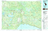
1985 Map of Manistique Lake
USGS Topo · Published 1989About this map
Seney National Wildlife Refuge dominates the western landscape of this mid-1980s Upper Peninsula survey, where the Manistique River and Fox River thread through extensive wetlands. This region is a study in the persistence of small lumber and rail outposts, with the Soo Line corridor connecting settlements like Seney, McMillan, and Newberry. Near Newberry, the State Hospital serves as a prominent landmark alongside several radio and lookout towers like Beech Hill Lookout.
Find a feature on this map
137 named features on this map. Tap any name to fly to it.
Don’t see what you’re looking for? This feature index may not catch every label — zoom into the map to look around manually.
Map Details
Editions of this 1985 Manistique Lake Map
2 editions found
Other maps of this area

1931 · Seney SW
USGS Topo · 1:31,680

1931 · Seney NW
USGS Topo · 1:31,680

1931 · Epoufette SE
USGS Topo · 1:31,680

1931 · Manistique River NE
USGS Topo · 1:31,680

1931 · Driggs Lake NE
USGS Topo · 1:31,680

1931 · Gould City NE
USGS Topo · 1:31,680

1931 · Epoufette NE
USGS Topo · 1:31,680

1931 · Seul Choix Point NE
USGS Topo · 1:31,680

1931 · Gould City NW
USGS Topo · 1:31,680

1931 · Epoufette NW
USGS Topo · 1:31,680