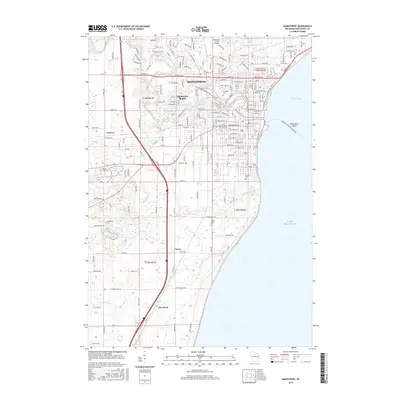
2015 Map of Manitowoc
USGS Topo · Published 2015About this map
The Manitowoc River and its smaller counterpart, the Little Manitowoc River, anchor this coastal landscape as they flow toward the deep waters of Lake Michigan. The city of Manitowoc dominates the shoreline of Maritime Bay, showing a complex grid of streets including Waldo Blvd and Michigan Ave. Inland, the terrain is dotted with several small glacial lakes, such as Silver Lake, Gass Lake, and Hartlaub Lake, which hint at the region's geological past.
Find a feature on this map
58 named features on this map. Tap any name to fly to it.
Don’t see what you’re looking for? This feature index may not catch every label — zoom into the map to look around manually.
Map Details
Editions of this 2015 Manitowoc Map
This is the sole edition of this map. No revisions or reprints were ever made.
Other maps of this area

1954 · Manitowoc
USGS Topo · 1:62,500

1954 · Cleveland
USGS Topo · 1:24,000

1954 · St. Wendel
USGS Topo · 1:24,000

1954 · Sheboygan North
USGS Topo · 1:62,500

1954 · Howards Grove
USGS Topo · 1:62,500

1954 · Reedsville
USGS Topo · 1:62,500

1954 · Manitowoc
USGS Topo · 1:24,000

1954 · Milwaukee
USGS Topo · 1:250,000

1954 · Manitowoc
USGS Topo · 1:250,000

1958 · Manitowoc
USGS Topo · 1:250,000