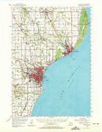
1954 Map of Manitowoc
USGS Topo · Published 1972About this map
Manitowoc and Two Rivers anchor this Lake Michigan shoreline survey, illustrating a mid-century industrial and maritime hub. The landscape is defined by the convergence of the West Twin River and East Twin River at Two Rivers, while the Manitowoc River serves the larger port to the south. Transportation networks are prominent, including the Chicago and North Western railroad and the Municipal Airport.
Find a feature on this map
73 named features on this map. Tap any name to fly to it.
Don’t see what you’re looking for? This feature index may not catch every label — zoom into the map to look around manually.
Map Details
Editions of this 1954 Manitowoc Map
2 editions found
Other maps of this area

1954 · Kewaunee
USGS Topo · 1:62,500

1954 · Manitowoc
USGS Topo · 1:62,500

1954 · Cleveland
USGS Topo · 1:24,000

1954 · St. Wendel
USGS Topo · 1:24,000

1954 · Sheboygan North
USGS Topo · 1:62,500

1954 · Denmark
USGS Topo · 1:62,500

1954 · Howards Grove
USGS Topo · 1:62,500

1954 · Reedsville
USGS Topo · 1:62,500

1954 · Manitowoc
USGS Topo · 1:24,000

1954 · Milwaukee
USGS Topo · 1:250,000