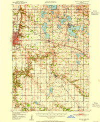
1950 Map of Mankato East
USGS Topo · Published 1955About this map
Mankato serves as the focal point for this mid-century survey, revealing the city's academic and industrial foundations through Teachers College, Good Counsel Academy, and nearby quarries. The landscape is defined by the winding Le Sueur River and Cobb River, which snake through a dense network of township sections and rural schoolhouses such as School No 131 and School No 139.
Find a feature on this map
87 named features on this map. Tap any name to fly to it.
Don’t see what you’re looking for? This feature index may not catch every label — zoom into the map to look around manually.
Map Details
Editions of this 1950 Mankato East Map
3 editions found
Other maps of this area

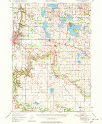
1950 · Mankato East
USGS Topo · 1:62,500

1951 · Mankato East
USGS Topo · 1:62,500

1951 · Mankato West
USGS Topo · 1:62,500

1953 · Saint Paul
USGS Topo · 1:250,000

1953 · New Ulm
USGS Topo · 1:250,000

1954 · Fairmont
USGS Topo · 1:250,000

1954 · Mason City
USGS Topo · 1:250,000

1957 · New Ulm
USGS Topo · 1:250,000

1957 · Mason City
USGS Topo · 1:250,000

1958 · New Ulm
USGS Topo · 1:250,000