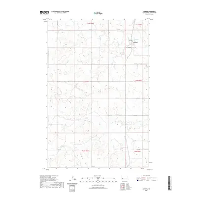
2020 Map of Manning
USGS Topo · Published 2020About this map
Manning serves as a small but vital hub for this section of the Great Plains, anchored by the Dunn County Court House and the nearby Manning Cem. The landscape is defined by the winding course of the Knife River, which is joined by Wolf Cr just north of the settlement. The surrounding terrain is a grid of section lines and rural roads such as 12th St SW and 113th Ave SW, reflecting the systematic land survey patterns of North Dakota's ranching and farming country.
Find a feature on this map
21 named features on this map. Tap any name to fly to it.
Don’t see what you’re looking for? This feature index may not catch every label — zoom into the map to look around manually.
Map Details
Editions of this 2020 Manning Map
This is the sole edition of this map. No revisions or reprints were ever made.
Other maps of this area

1953 · Watford City
USGS Topo · 1:250,000

1957 · Watford City
USGS Topo · 1:250,000

1967 · Watford City
USGS Topo · 1:250,000

1973 · Manning SE
USGS Topo · 1:24,000
1973 · New Hradec North
USGS Topo · 1:24,000
1973 · Hirschville SW
USGS Topo · 1:24,000

1973 · Manning
USGS Topo · 1:24,000

1973 · Manning NW
USGS Topo · 1:24,000

1973 · Emerson
USGS Topo · 1:24,000

1973 · Lake Ilo
USGS Topo · 1:24,000