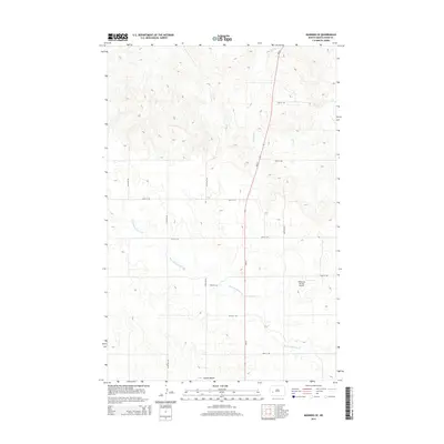
2014 Map of Manning SE
USGS Topo · Published 2014About this map
Russian Spring Cr meanders across this rural section of Dunn County, carving a series of small coulees through the high plains of western North Dakota. The landscape is defined by the prominent Camels Butte in the south, a landmark rising above the surrounding agricultural grid. Transportation is anchored by the north-south corridor of ND-22, which intersects a network of gravel section roads such as 24th St SW and 110th Ave SW. This area remains largely open ranchland and field, marked by the intermittent flow of Lighting Cr and Deep Cr. A distinctive local landmark in this sparsely settled region is Wolberg's Private Airport, located near the junction of several section lines, indicating the importance of private aviation for transport and land management in the expansive Great Plains terrain.
Find a feature on this map
17 named features on this map. Tap any name to fly to it.
Don’t see what you’re looking for? This feature index may not catch every label — zoom into the map to look around manually.
Map Details
Editions of this 2014 Manning SE Map
This is the sole edition of this map. No revisions or reprints were ever made.
Other maps of this area

1953 · Dickinson
USGS Topo · 1:250,000

1953 · Watford City
USGS Topo · 1:250,000

1957 · Dickinson
USGS Topo · 1:250,000

1957 · Watford City
USGS Topo · 1:250,000

1959 · Dickinson North
USGS Topo · 1:24,000

1962 · Davis Buttes
USGS Topo · 1:24,000

1967 · Watford City
USGS Topo · 1:250,000

1973 · Manning SE
USGS Topo · 1:24,000

1973 · New Hradec South
USGS Topo · 1:24,000
1973 · New Hradec North
USGS Topo · 1:24,000