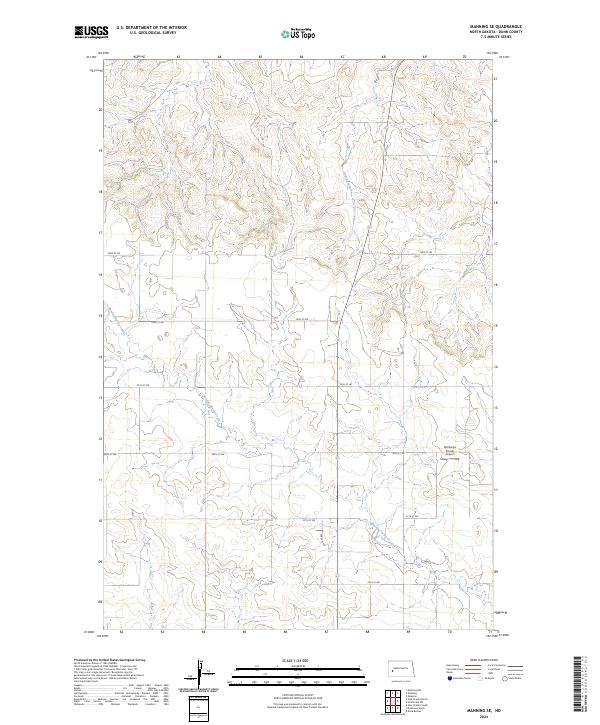
2024 Map of Manning SE
USGS Topo · Published 2024About this map
Russian Spring Creek and Lighting Creek carve a distinct drainage pattern across this section of the North Dakota uplands in Dunn County. The landscape is defined by the rigid geometry of the Public Land Survey System, with gravel roads like 23rd St SW and 26th St SW tracing the township and section lines. A notable site of modern activity is Wolberg's Private Airport, situated in the eastern half of the quadrangle. This 2024 survey reflects the persistent rural character of the region, where transportation is dictated by a strict grid of numeric avenues and streets, such as 109e Ave SW, which serve the scattered farmsteads and ranch lands of the high plains.
Find a feature on this map
15 named features on this map. Tap any name to fly to it.
Don’t see what you’re looking for? This feature index may not catch every label — zoom into the map to look around manually.
Map Details
Editions of this 2024 Manning SE Map
This is the sole edition of this map. No revisions or reprints were ever made.
Other maps of this area

1953 · Dickinson
USGS Topo · 1:250,000

1953 · Watford City
USGS Topo · 1:250,000

1957 · Dickinson
USGS Topo · 1:250,000

1957 · Watford City
USGS Topo · 1:250,000

1959 · Dickinson North
USGS Topo · 1:24,000

1962 · Davis Buttes
USGS Topo · 1:24,000

1967 · Watford City
USGS Topo · 1:250,000

1973 · Manning SE
USGS Topo · 1:24,000

1973 · New Hradec South
USGS Topo · 1:24,000
1973 · New Hradec North
USGS Topo · 1:24,000