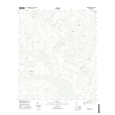
2017 Map of Manningtown
USGS Topo · Published 2017About this map
Manningtown serves as the primary settlement in this corner of Wayne County, where the landscape is defined by an intricate network of wetlands and low-lying rises known as islands. The geography is dominated by large saturated basins such as Big Cypress Swamp and the Little Okefenokee Swamp, which feed into various drainages like Honey Camp Br and Oak Pond Br. These swampy expanses are punctuated by slightly higher ground, including Strickland Island, Downing Island, and Palmetto Island, which likely provided the only stable sites for early local navigation and habitation.
Find a feature on this map
36 named features on this map. Tap any name to fly to it.
Don’t see what you’re looking for? This feature index may not catch every label — zoom into the map to look around manually.
Map Details
Editions of this 2017 Manningtown Map
This is the sole edition of this map. No revisions or reprints were ever made.
Other maps of this area

1918 · Jesup
USGS Topo · 1:62,500

1918 · Hortense
USGS Topo · 1:62,500

1918 · Everett City
USGS Topo · 1:62,500

1920 · Everett City
USGS Topo · 1:62,500

1943 · Ludowici
USGS Topo · 1:62,500

1943 · Jesup
USGS Topo · 1:62,500

1944 · Everett City
USGS Topo · 1:62,500

1944 · Hortense
USGS Topo · 1:62,500

1946 · Brunswick
USGS Topo · 1:250,000

1948 · Brunswick
USGS Topo · 1:250,000