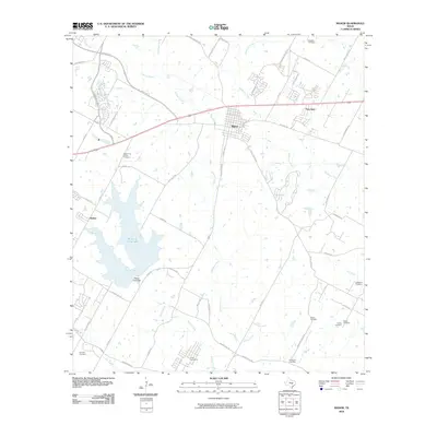
2010 Map of Manor
USGS Topo · Published 2010About this map
Manor serves as the central hub of this Travis County landscape, situated where the grid of the town site meets a network of waterways and early transit routes. The presence of numerous burial sites, including Jones Cemeteries, Rosehill Cemetery, and the Decker Free Cemetery near the Decker Free Church, provides a dense record of the area's early settlement families and community centers. These locations are scattered among a drainage system defined by Gilleland Creek and Wilbarger Creek.
Find a feature on this map
55 named features on this map. Tap any name to fly to it.
Don’t see what you’re looking for? This feature index may not catch every label — zoom into the map to look around manually.
Map Details
Editions of this 2010 Manor Map
This is the sole edition of this map. No revisions or reprints were ever made.
Other maps of this area

1885 · Bastrop
USGS Topo · 1:125,000

1893 · Bastrop
USGS Topo · 1:125,000

1896 · Austin
USGS Topo · 1:125,000

1897 · Austin
USGS Topo · 1:125,000

1904 · Bastrop
USGS Topo · 1:125,000

1910 · Austin
USGS Topo · 1:125,000

1948 · Elgin
USGS Topo · 1:62,500

1948 · Bastrop
USGS Topo · 1:62,500

1950 · Bastrop
USGS Topo · 1:62,500

1950 · Elgin
USGS Topo · 1:62,500