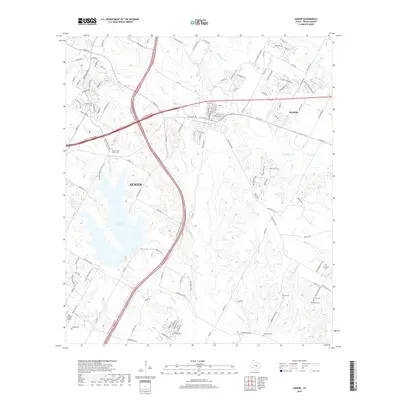
2019 Map of Manor
USGS Topo · Published 2019About this map
Walter E. Long Lake dominates the western landscape in this 2019 survey of the eastern fringes of Austin and the neighboring community of Manor. The terrain is defined by a dense network of tributaries including Gilleland Cr, Wilbarger Cr, and Decker Cr, which carve through the land north of Elm Cr. This area represents a complex intersection of modern infrastructure and deep-rooted local history, where the expanding suburbs of Travis County meet established sites like the Bud Dryden Airport.
Find a feature on this map
117 named features on this map. Tap any name to fly to it.
Don’t see what you’re looking for? This feature index may not catch every label — zoom into the map to look around manually.
Map Details
Editions of this 2019 Manor Map
This is the sole edition of this map. No revisions or reprints were ever made.
Other maps of this area

1885 · Bastrop
USGS Topo · 1:125,000

1893 · Bastrop
USGS Topo · 1:125,000

1896 · Austin
USGS Topo · 1:125,000

1897 · Austin
USGS Topo · 1:125,000

1904 · Bastrop
USGS Topo · 1:125,000

1910 · Austin
USGS Topo · 1:125,000

1948 · Elgin
USGS Topo · 1:62,500

1948 · Bastrop
USGS Topo · 1:62,500

1950 · Bastrop
USGS Topo · 1:62,500

1950 · Elgin
USGS Topo · 1:62,500