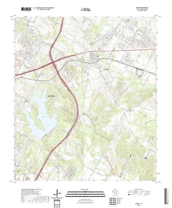
2022 Map of Manor
USGS Topo · Published 2022About this map
The expanding northeastern outskirts of Austin and the growing city of Manor dominate this contemporary landscape in eastern Travis County. The terrain is defined by the significant reservoir of Walter E. Long Lake, which serves as a central geographic anchor between the two municipalities. A dense network of modern infrastructure, including the multi-lane Texas State Highway 130 and US Highway 290, overlays an older rural footprint marked by numerous small family cemeteries and parish sites.
Find a feature on this map
123 named features on this map. Tap any name to fly to it.
Don’t see what you’re looking for? This feature index may not catch every label — zoom into the map to look around manually.
Map Details
Editions of this 2022 Manor Map
This is the sole edition of this map. No revisions or reprints were ever made.
Other maps of this area

1885 · Bastrop
USGS Topo · 1:125,000

1893 · Bastrop
USGS Topo · 1:125,000

1896 · Austin
USGS Topo · 1:125,000

1897 · Austin
USGS Topo · 1:125,000

1904 · Bastrop
USGS Topo · 1:125,000

1910 · Austin
USGS Topo · 1:125,000

1948 · Elgin
USGS Topo · 1:62,500

1948 · Bastrop
USGS Topo · 1:62,500

1950 · Bastrop
USGS Topo · 1:62,500

1950 · Elgin
USGS Topo · 1:62,500