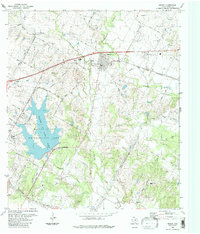
1988 Map of Manor
USGS Topo · Published 1988About this map
Manor stands as a central hub in northeastern Travis County, shown here during a period of transition as the Austin Corporate Boundary began to push eastward. The landscape is defined by the significant waters of Walter E Long Lake, which dominates the western portion of the sheet, and a network of creeks including Gilleland Creek and Wilbarger Creek. Historically significant sites for genealogists are numerous, featuring the Decker Free Church and a high concentration of family or local burial grounds such as Rosehill Cem, Brown Cem, and Lockwood Cem.
Find a feature on this map
52 named features on this map. Tap any name to fly to it.
Don’t see what you’re looking for? This feature index may not catch every label — zoom into the map to look around manually.
Map Details
Editions of this 1988 Manor Map
This is the sole edition of this map. No revisions or reprints were ever made.
Other maps of this area

1885 · Bastrop
USGS Topo · 1:125,000

1893 · Bastrop
USGS Topo · 1:125,000

1896 · Austin
USGS Topo · 1:125,000

1897 · Austin
USGS Topo · 1:125,000

1904 · Bastrop
USGS Topo · 1:125,000

1910 · Austin
USGS Topo · 1:125,000

1948 · Elgin
USGS Topo · 1:62,500

1948 · Bastrop
USGS Topo · 1:62,500

1950 · Bastrop
USGS Topo · 1:62,500

1950 · Elgin
USGS Topo · 1:62,500