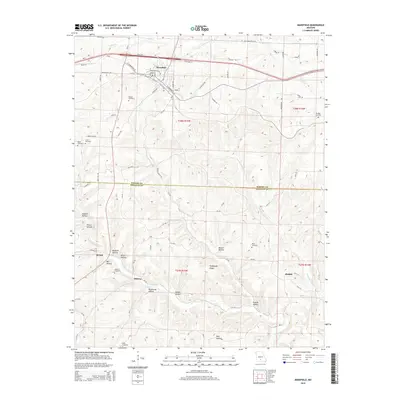
2015 Map of Mansfield
USGS Topo · Published 2015About this map
Mansfield occupies the northern portion of this Wright and Douglas County landscape, serving as a hub where Mo-B and Mo-F meet near the Burlington Northern rail line. The terrain transitions from the developed streets of the town into a series of deeply etched drainage basins and ridges to the south. Numerous family-named cemeteries are scattered across these hills, including the Deaker Cemetery, Wallace Cemetery, and Keith Cemetery, providing valuable points of reference for local historians.
Find a feature on this map
75 named features on this map. Tap any name to fly to it.
Don’t see what you’re looking for? This feature index may not catch every label — zoom into the map to look around manually.
Map Details
Editions of this 2015 Mansfield Map
This is the sole edition of this map. No revisions or reprints were ever made.
Other maps of this area

1936 · Ava
USGS Topo · 1:48,000

1937 · Buckhart
USGS Topo · 1:48,000

1942 · Ava
USGS Topo · 1:62,500

1943 · Buckhart
USGS Topo · 1:62,500

1945 · Ava
USGS Topo · 1:62,500

1945 · Harrison
USGS Topo · 1:250,000

1945 · Buckhart
USGS Topo · 1:62,500

1949 · Harrison
USGS Topo · 1:250,000

1951 · Norwood
USGS Topo · 1:24,000

1951 · Owens
USGS Topo · 1:24,000