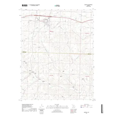
2017 Map of Mansfield
USGS Topo · Published 2017About this map
Mansfield sits at a critical junction of the BNSF Railway and local travel routes, serving as the primary hub in this Ozark transition zone. The landscape is deeply incised by a network of drainage ways including Wolf Cr and Bryant Cr, creating numerous hollows such as Smelter Hollow, Buzzard Hollow, and Mill Hollow. These topographical features often dictated the location of early farmsteads and rural communities like Midway and Olathia. Genealogy researchers will find significant value in the high density of family and community burial grounds documented here, ranging from Wallace Cem and Keith Cem to the Findley Cem near the eastern margin. The map traces the shift from traditional routes like Old Hwy 60 to contemporary infrastructure, while names like Shinpaugh Ridge preserve the memory of the families who settled this dissected plateau.
Find a feature on this map
96 named features on this map. Tap any name to fly to it.
Don’t see what you’re looking for? This feature index may not catch every label — zoom into the map to look around manually.
Map Details
Editions of this 2017 Mansfield Map
This is the sole edition of this map. No revisions or reprints were ever made.
Other maps of this area

1936 · Ava
USGS Topo · 1:48,000

1937 · Buckhart
USGS Topo · 1:48,000

1942 · Ava
USGS Topo · 1:62,500

1943 · Buckhart
USGS Topo · 1:62,500

1945 · Ava
USGS Topo · 1:62,500

1945 · Harrison
USGS Topo · 1:250,000

1945 · Buckhart
USGS Topo · 1:62,500

1949 · Harrison
USGS Topo · 1:250,000

1951 · Norwood
USGS Topo · 1:24,000

1951 · Owens
USGS Topo · 1:24,000