2021 Map of Mansfield
USGS Topo · Published 2021About this map
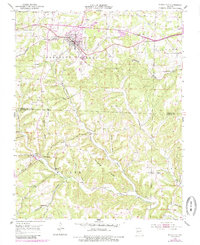
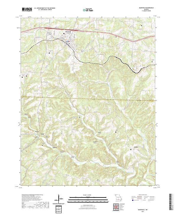
Mansfield sits at the northern edge of this Ozark plateau landscape, where the street grid transitions into the winding country roads of Wright Co and Douglas Co. The town center, organized around W Commercial St and N Broad Ave, serves as a local hub above the rugged topography of the southern quadrangle. South of the main settlement, the terrain is defined by a dense network of hollows, including Mill Hollow and Buzzard Hollow, which drain toward Bryant Cr. These natural corridors shaped early settlement patterns, visible in the placement of small communities like Midway and Olathia. For genealogists, the map is a significant record of local family history, preserving the locations of numerous small burial grounds such as Deaker Cem, Wallace Cem, and Keith Cem that are tucked away near the ridges and creek beds.
Find a feature on this map
88 named features on this map. Tap any name to fly to it.
Don’t see what you’re looking for? This feature index may not catch every label — zoom into the map to look around manually.
Map Details
Editions of this 2021 Mansfield Map
This is the sole edition of this map. No revisions or reprints were ever made.
Historical Maps of Midway Through Time
3 maps found